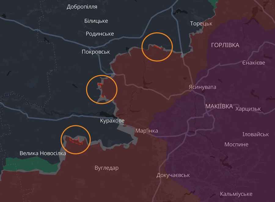
The russian occupiers have captured one settlement and advanced near three more in the west of the Donetsk Region.
Analysts of the DeepState OSINT project reported this on November 8.
On the Pokrovsk axis, the russians allegedly occupied a number of positions north of the settlement of Novooleksandrivka.
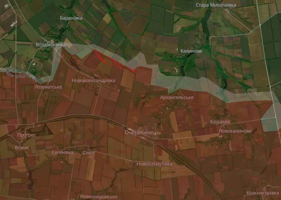 Screenshot of the DeepState interactive map
To the west of the previously occupied town of Selydove, the russians captured the village of Novooleksiivka and advanced near Novodmytrivka.
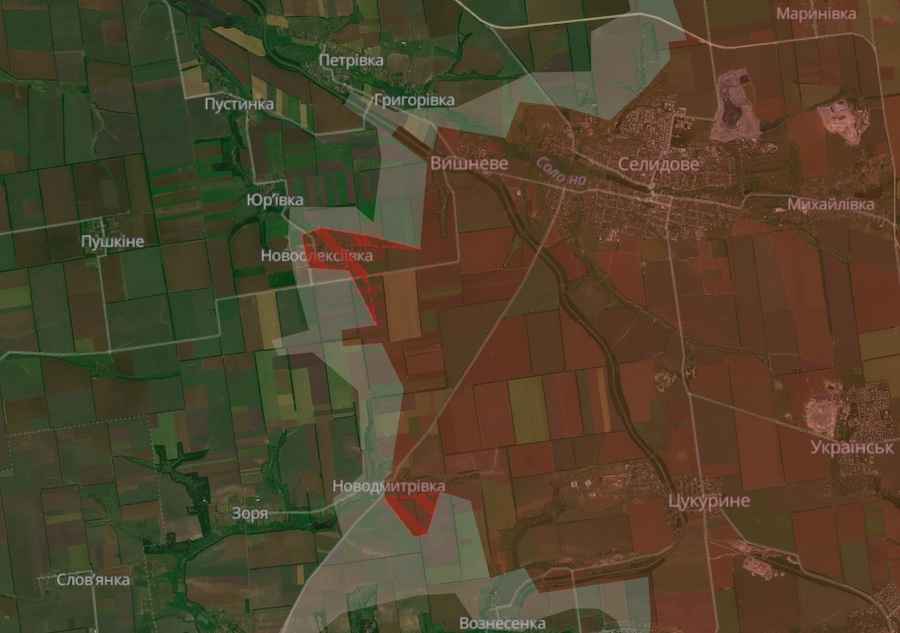 Screenshot of the DeepState interactive map
And on the southern flank of Kurakhove, russian troops allegedly occupied a number of positions near Maksymivka.
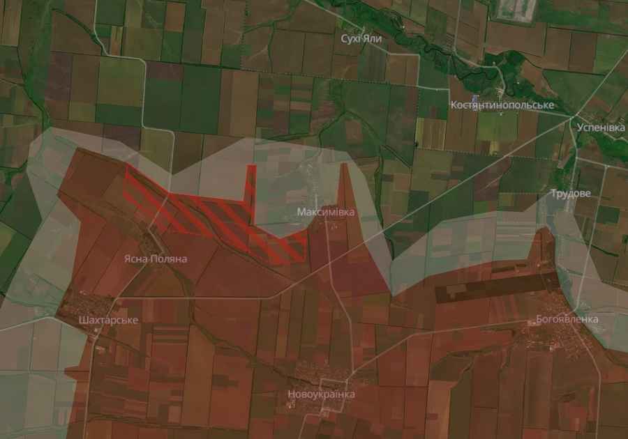 Screenshot of the DeepState interactive map
On the general map of DeepState, the latest advances of the occupiers look like this.
 Screenshot of the DeepState interactive map
As the Ukrainian News agency earlier reported, on November 7, russian invaders shelled the town of Mykolaivka in the Sloviansk District of the Donetsk Region. Seven people became victims of the strike, two of them were killed.
Recall that the day before it became known that the Google Maps service removed images of military objects of Ukraine from its satellite map.
We also reported that the British intelligence announced the reason for the recent successes of the russians in the west of the Donetsk Region.
Who we are: About us, Contacts. How we write news and our principles: Editorial code. We did our best. If you found this valuable – please support us.
To request a correction, please send an email.