The Ministry of Defense of the aggressor country russia has published a map that allegedly shows the advance of the russian army since the beginning of 2025. The names of the settlements on it indicate that this map is about 50 years old.
The corresponding map was published by the russian Defense Ministry on its official Telegram channel.
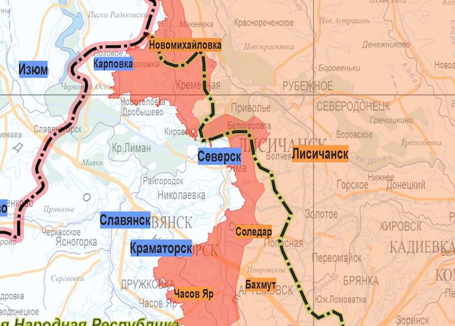
The first thing that catches your eye is the section of the map with the northern part of the Donetsk Region. On it, the russians marked the current frontline city of Siversk. With this designation, they showed that the city is under the control of Ukraine.
Under the mark you can see the word "Yama". This is how Siversk was called until 1973. The village of Yama appeared in 1909-1913, it was the administrative center of the Yama District until 1959.
It is also striking that the russian Defense Ministry for some reason marked Bakhmut as Bakhmut. After all, the Russians do not recognize the renaming of settlements. And modern Bakhmut was Artemivsk until 2016.
 Map of the occupiers. Photo: screenshot.
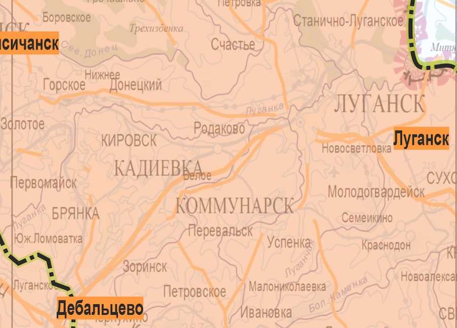
Evidence that the russian Defense Ministry uses old maps is also several cities in the Luhansk Region. This is the currently occupied Alchevsk, which in 1961-1991 was called Kommunarsk.
Nearby on the russian map you can see the city of Kadiivka. Since 2016, the settlement had this name, but from 1978 to 2016 it was called Stakhanov. It was also called Kadiivka from 1940 to 1978.
 Map of the occupiers. Photo: screenshot.
At least these three cases indicate that the russian Defense Ministry used a map that is at least 40 years old to mark its "successes."
As the Ukrainian News agency earlier reported, back in July 2022, the Security Service of Ukraine published a topographic map found with the occupiers. It is dated 1969.
We also wrote that bandages and dressing bags made more than 70 years ago were found in the first-aid kit of soldiers of the "Second World Army."
Who we are: About us, Contacts. How we write news and our principles: Editorial code. We did our best. If you found this valuable – please support us.
To request a correction, please send an email.