
Analysts of the Ukrainian OSINT project DeepState announced a new advance of the russian occupiers in the town of Toretsk, as well as on the flanks of the town of Kurakhove in the west of the Donetsk Region.
This is evidenced by the latest update of the DeepState interactive map.
According to OSINT analysts, the russians managed to expand the control zone in the central part of Toretsk.
 Screenshot of the DeepState interactive map
In the west of the Donetsk Region, the occupiers advanced near four settlements north and south of Kurakhove.
On the northern flank of Kurakhove, the enemy's advance was recorded near the settlements of Novooleksiyivka and Kreminna Balka (marked on the map with an orange circle).
 Screenshot of the DeepState interactive map
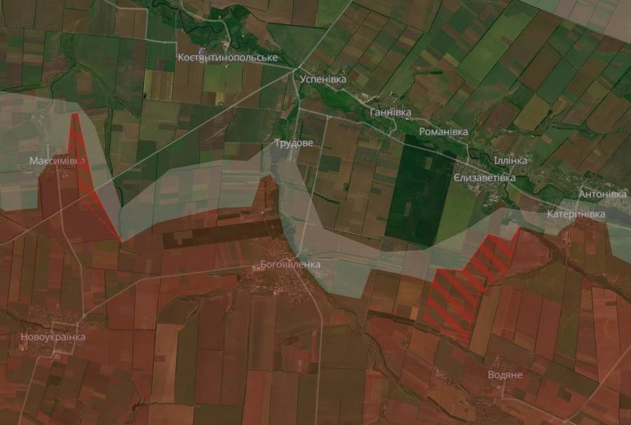
And to the south of the town, the occupiers took a number of positions near Bohoyavlenka and Maksymivka.
 Screenshot of the DeepState interactive map
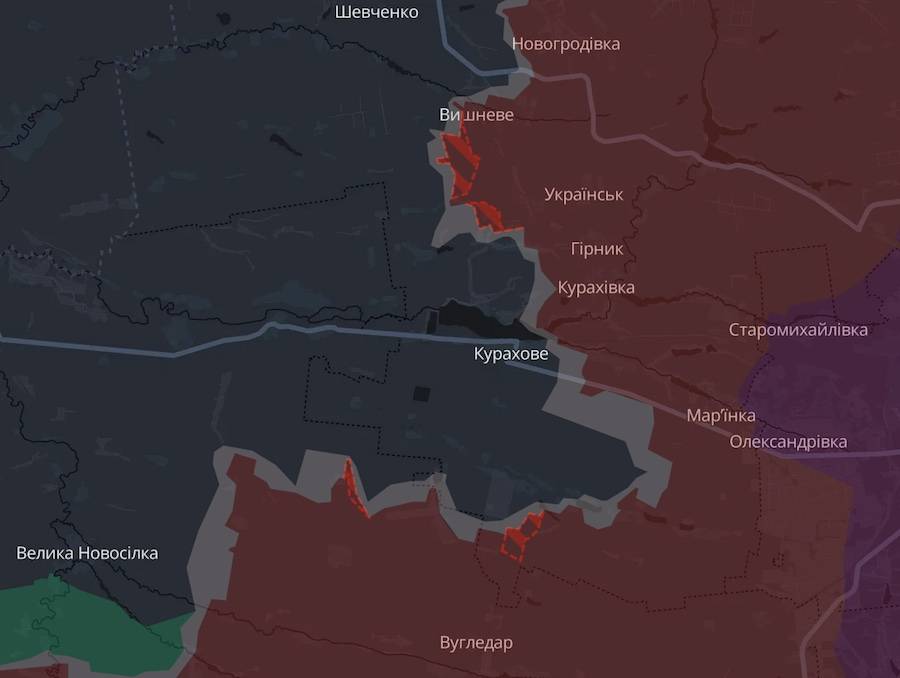
The situation in the Kurakhove Axis on the general map of DeepState looks as follows.
 Screenshot of the DeepState interactive map
Nobody commented on this information officially. As of this moment, it has not been confirmed or denied in the Defense Forces of Ukraine.
As Ukrainian News Agency earlier reported, yesterday evening the General Staff of the Armed Forces of Ukraine published a summary in which it stated that the occupiers are most active on two sections of the front in the Donetsk Region.
We will remind, on November 5, the Ministry of Defense of Great Britain in its intelligence review named the reason for the recent successes of the russians in the west of the Donetsk Region.
Who we are: About us, Contacts. How we write news and our principles: Editorial code. We did our best. If you found this valuable – please support us.
To request a correction, please send an email.