
Satellite images of settlements in the north of the Sumy Region, where fighting has been going on since February 2025 after the retreat of the Ukrainian Defense Forces from the territory of the Kursk Oblast of the russian aggressor country, have been published online.
The images were published by the 'Cartographer of the Armed Forces of Ukraine' Telegram channel on Thursday, April 2.
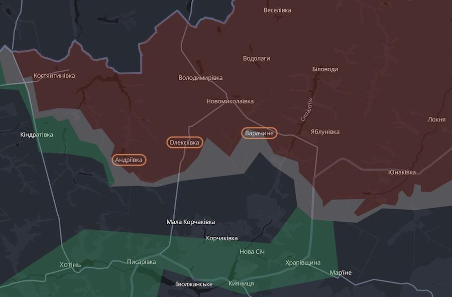
The settlements in question are Andriivka, Oleksiivka and Varachyne, located a few kilometers south of the state border.
 Andriivka, Oleksiivka and Varachyne on the map of the DeepState project. Photo: screenshot.
The images were taken in the summer of 2025, a few months after the start of active hostilities in this area of the frontline. It can be seen that the settlements have virtually ceased to exist - the images show the continuous ruins of residential buildings and other buildings.
The images also show a lot of craters. The largest of them are caused by the hits of mortars, artillery and guided aerial bombs of the occupiers.
Given that the images were taken almost a year ago, the degree of destruction of these settlements is likely to be even greater now.
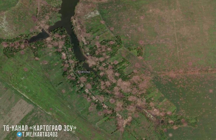 Photo: t.me/karta2402.
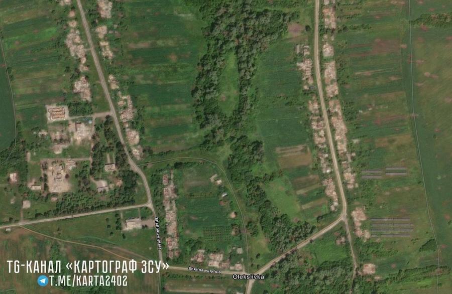 Photo: t.me/karta2402.
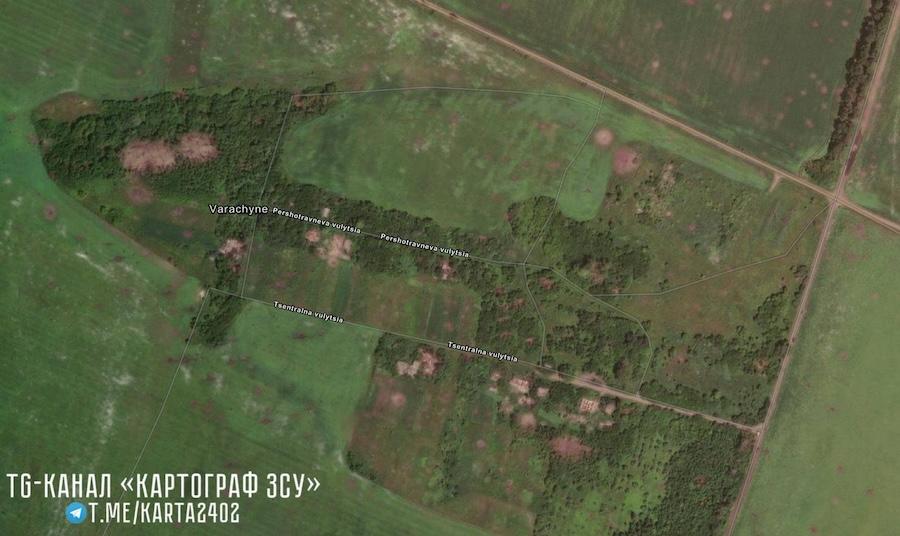 Photo: t.me/karta2402.
And in this image, according to the author, you can see several piles of so-called "dragon's teeth" used on defensive lines to prevent the movement of equipment. They are located near the village of Yunakivka. It remains unclear why they were not used
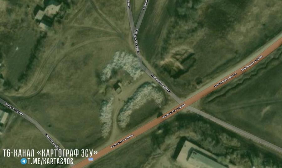 Photo: t.me/karta2402.
Battles in the north of the Sumy Region began in the second half of February 2025 after the Ukrainian military withdrew from the territory of the Kursk Oblast. Fighting in this area continues to this day.
According to the DeepState analytical project, the approximate front line in this area is as follows.
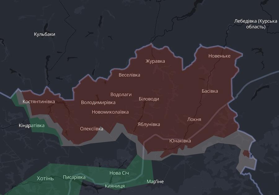 Photo: screenshot of the DeepState map.
As the Ukrainian News agency earlier reported, on April 2, OSINT analysts published satellite images of the russian port of Ust-Luga. They show the consequences of strikes by Ukrainian UAVs over the past weeks.
In February of this year, photos of Pokrovsk, Donetsk Region were published online, showing the extent of the city's destruction as a result of hostilities.
Who we are: About us, Contacts. How we write news and our principles: Editorial code. We did our best. If you found this valuable – please support us.
To request a correction, please send an email.